Bligh Island Marine Provincial Park
Tools
Actions
General
Print/export
In other projects
Appearance
From Wikipedia, the free encyclopedia
Provincial park in British Columbia, Canada
| Bligh Island Marine Provincial Park | |
|---|---|
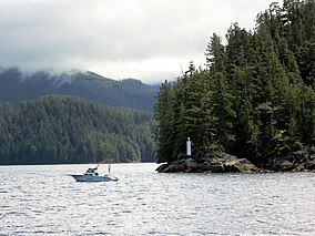
 Bligh Island on Muchalat Inlet, British Columbia | |
| Location | Nootka Land District, British Columbia, Canada |
| Nearest city | Yuquot, BC |
| Coordinates | 49°37′59″N 126°32′35″W / 49.63306°N 126.54306°W / 49.63306; -126.54306 |
| Area | 4,456 ha. (44.56 km2) |
| Established | July 13, 1995 |
| Governing body | BC Parks |
 | |
Bligh Island Marine Provincial Park is a provincial park in British Columbia, Canada.
The park encompasses several islands in Nootka Sound, including Bligh Island, the Villaverde Islands, and the Pantoja Islands.[1]
See also
[edit]References
[edit]- ^ "Bligh Island Marine Provincial Park". BC Parks. BC Parks. January 4, 2021. Retrieved August 25, 2021.
External links
[edit]- Bligh Island Marine Provincial Park - BC Parks site.
- Map
- "Bligh Island Marine Park". BC Geographical Names.
49°38′00″N 126°32′30″W / 49.63333°N 126.54167°W / 49.63333; -126.54167
This British Columbia protected areas related article is a stub. You can help Wikipedia by expanding it. |


